
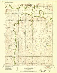
1953 Map of Glen Elder South
USGS Topo · Published 1954About this map
The Solomon River corridor defines the northern reach of this Mitchell County landscape, where the Missouri Pacific railroad parallels the water just east of Glen Elder. This mid-century survey reveals a rural society structured around local civic hubs, with numerous small schools and churches serving the agricultural uplands. South of the river, the drainage of Walnut Creek and its tributaries dominates the terrain, featuring the Walnut Creek Dam. Local history is preserved through named community markers such as Naomi Ch and Glenview Ch, alongside several rural cemeteries like High Prairie Cem and Honey Creek Cem. The transition from river valley to higher ground is marked by small-scale infrastructure, including a Landing Field in the southern portion and several gravel operations that supported the local road network during this era.
Find a feature on this map
30 named features on this map. Tap any name to fly to it.
Don’t see what you’re looking for? This feature index may not catch every label — zoom into the map to look around manually.
Map Details
Editions of this 1953 Glen Elder South Map
3 editions found
Other maps of this area

1894 · Mankato
USGS Topo · 1:125,000

1894 · Beloit
USGS Topo · 1:125,000

1953 · Solomon Rapids
USGS Topo · 1:24,000

1953 · Waconda Springs
USGS Topo · 1:24,000

1955 · Beloit
USGS Topo · 1:250,000

1959 · Beloit
USGS Topo · 1:250,000

1962 · Cawker City
USGS Topo · 1:24,000

1962 · Glen Elder North
USGS Topo · 1:24,000

1962 · Jewell SW
USGS Topo · 1:24,000

1968 · Beloit SW
USGS Topo · 1:24,000