
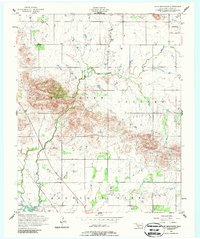
1956 Map of Glen Mountains
USGS Topo · Published 1959About this map
Glen Mountains dominate this central Kiowa County landscape, rising sharply above the surrounding plains during the mid-1950s. The settlement of Cooperton sits in the northeast corner, while the northern edge of Mountain Park anchors the southern boundary near the banks of Snyder Lake. This era of documentation reveals a transition from mineral extraction to a more settled rural economy, noted by a Gold Mine (Abandoned) south of the ridge. The path of the St Louis San Francisco railroad cuts through the southwestern corner, following the natural corridors formed by West Otter Creek and Glen Creek. These waterways, including the prominent Otter Creek, define the drainage patterns of the Cooper and Otter Creek regions, providing a clear view of the area's geological and logistical layout before modern expansion.
Find a feature on this map
12 named features on this map. Tap any name to fly to it.
Don’t see what you’re looking for? This feature index may not catch every label — zoom into the map to look around manually.
Map Details
Editions of this 1956 Glen Mountains Map
2 editions found
Other maps of this area

1949 · Cooperton
USGS Topo · 1:62,500

1950 · Snyder
USGS Topo · 1:62,500

1955 · Lawton
USGS Topo · 1:250,000

1956 · Cooperton
USGS Topo · 1:24,000

1956 · Odetta
USGS Topo · 1:24,000

1956 · Unap Mountain
USGS Topo · 1:24,000

1956 · Snyder
USGS Topo · 1:24,000

1956 · Rainy Mountain Creek
USGS Topo · 1:24,000

1956 · Snyder
USGS Topo · 1:62,500

1956 · Cooperton
USGS Topo · 1:62,500