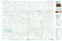
1980 Map of Glen Ullin
USGS Topo · Published 1980About this map
Glen Ullin and New Salem serve as the primary anchors for this region of western North Dakota, situated along the corridor of the Northern Burlington transit lines. The landscape is defined by the Curlew Valley and a series of prominent topographic landmarks including Twin Buttes, Eagle Nest, and Heart Butte. The presence of a Strip Mine north of New Salem indicates the local extraction industry, while the sprawling Lake Tschida and Heart Butte Reservoir to the south dominate the hydrological landscape.
Find a feature on this map
83 named features on this map. Tap any name to fly to it.
Don’t see what you’re looking for? This feature index may not catch every label — zoom into the map to look around manually.
Map Details
Editions of this 1980 Glen Ullin Map
This is the sole edition of this map. No revisions or reprints were ever made.
Other maps of this area

1907 · Bismarck
USGS Topo · 1:125,000

1938 · Heart Butte
USGS Topo · 1:48,000

1944 · Heart Butte
USGS Topo · 1:62,500

1950 · Wilton
USGS Topo · 1:62,500

1951 · Bismarck
USGS Topo · 1:62,500

1951 · Mandan
USGS Topo · 1:24,000

1953 · Dickinson
USGS Topo · 1:250,000

1953 · Watford City
USGS Topo · 1:250,000

1954 · Bismarck
USGS Topo · 1:250,000

1954 · McClusky
USGS Topo · 1:250,000