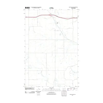
2011 Map of Glen Ullin SW
USGS Topo · Published 2011About this map
Eagle Nest anchors the northern portion of this Morton County landscape, situated near the intersection of major thoroughfares and rural section lines. The terrain is defined by two primary drainage systems: Big Muddy Creek, which winds through the northern half of the quadrangle, and Heart Butte Creek, which meanders across the southern plains. The map reflects a structured rural grid of roads including 70th Ave, 71st Ave, and 72nd Ave, which provide access to the agricultural plots and homesteads of the region. This 2011 survey captures the area's modern infrastructure, including the Frontage Rd and County Rd 139, illustrating how transportation networks follow the natural path of the local waterways.
Find a feature on this map
19 named features on this map. Tap any name to fly to it.
Don’t see what you’re looking for? This feature index may not catch every label — zoom into the map to look around manually.
Map Details
Editions of this 2011 Glen Ullin SW Map
This is the sole edition of this map. No revisions or reprints were ever made.
Other maps of this area

1938 · Heart Butte
USGS Topo · 1:48,000

1944 · Heart Butte
USGS Topo · 1:62,500

1953 · Dickinson
USGS Topo · 1:250,000

1954 · Bismarck
USGS Topo · 1:250,000

1957 · Dickinson
USGS Topo · 1:250,000

1958 · Bismarck
USGS Topo · 1:250,000

1960 · Glen Ullin
USGS Topo · 1:24,000

1960 · Heart Butte NW
USGS Topo · 1:24,000

1960 · Clark Butte NE
USGS Topo · 1:24,000

1960 · Heart Butte
USGS Topo · 1:24,000