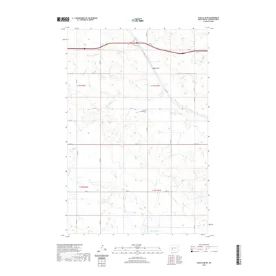
2020 Map of Glen Ullin SW
USGS Topo · Published 2020About this map
German Congregational Cem stands as a central historical landmark within this rural Morton County landscape, providing a primary point of reference for genealogists and local historians. The surrounding terrain is defined by the winding course of Big Muddy Cr in the north and the upper reaches of Heart Butte Cr in the south. A prominent natural feature, Eagle Nest, rises near the center of the sheet, overlooking the intersection of section lines and early county roads. This survey documents the systematic organization of the Dakota prairie through the Public Land Survey System, shown by the clearly marked township boundaries of t139n r90w and t138n r89w. The map preserves the grid of rural transit including Co RD 139 and Co RD 90, which connect the isolated homesteads and farmland of this high plains region.
Find a feature on this map
23 named features on this map. Tap any name to fly to it.
Don’t see what you’re looking for? This feature index may not catch every label — zoom into the map to look around manually.
Map Details
Editions of this 2020 Glen Ullin SW Map
This is the sole edition of this map. No revisions or reprints were ever made.
Other maps of this area

1938 · Heart Butte
USGS Topo · 1:48,000

1944 · Heart Butte
USGS Topo · 1:62,500

1953 · Dickinson
USGS Topo · 1:250,000

1954 · Bismarck
USGS Topo · 1:250,000

1957 · Dickinson
USGS Topo · 1:250,000

1958 · Bismarck
USGS Topo · 1:250,000

1960 · Glen Ullin
USGS Topo · 1:24,000

1960 · Heart Butte NW
USGS Topo · 1:24,000

1960 · Clark Butte NE
USGS Topo · 1:24,000

1960 · Heart Butte
USGS Topo · 1:24,000