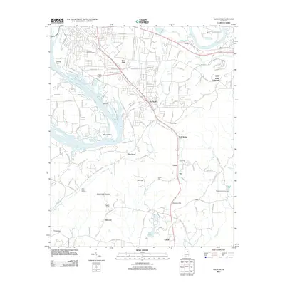
2011 Map of Glencoe
USGS Topo · Published 2011About this map
Glencoe and its surrounding communities are defined by the winding course of the Coosa River, which carves through the landscape to create distinctive landforms like Whorton Bend and Keeling Island. This 2011 survey captures a mix of residential growth and industrial legacy in Etowah County, where the valley floor is punctuated by gaps in the ridges, such as Davis Gap and Alexander Gap. The map documents the local road network connecting established settlements like Cobb City and Ewing to the regional centers.
Find a feature on this map
163 named features on this map. Tap any name to fly to it.
Don’t see what you’re looking for? This feature index may not catch every label — zoom into the map to look around manually.
Map Details
Editions of this 2011 Glencoe Map
This is the sole edition of this map. No revisions or reprints were ever made.
Other maps of this area

1885 · Gadsden
USGS Topo · 1:125,000

1888 · Gadsden
USGS Topo · 1:125,000

1889 · Springville
USGS Topo · 1:125,000

1892 · Springville
USGS Topo · 1:125,000

1892 · Gadsden
USGS Topo · 1:125,000

1893 · Fort Payne
USGS Topo · 1:125,000

1895 · Gadsden
USGS Topo · 1:125,000
1898 · Fort Payne
USGS Topo · 1:125,000
1900 · Fort Payne
USGS Topo · 1:125,000

1900 · Anniston
USGS Topo · 1:125,000