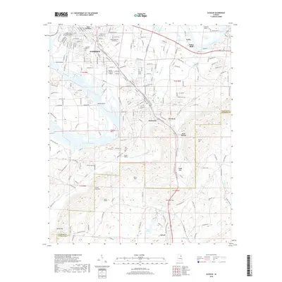
2018 Map of Glencoe
USGS Topo · Published 2018About this map
Glencoe and Gadsden define this Etowah County landscape, where the Coosa River bends sharply around Keeling Island and Whorton Bend. The terrain transitions from the developed corridors of E Meighan Blvd and the Gadsden State Community College Wallace Drive Campus into the prominent ridges of Colvin Mtn and Greens Creek Mtn. Small communities like Keysburg, Cobb City, and Colwell are situated along the historic routes of Old US Hwy 431 and Old Anniston Gadsden Hwy. Local history is anchored by sites such as Pine Grove Cem and Crestwood Memorial Cem, while the natural topography is marked by distinct passages through the highlands, including Davis Gap and Alexander Gap. The southern portion of the sheet shows the headwaters of Ohatchee Creek winding through Burns Valley.
Find a feature on this map
46 named features on this map. Tap any name to fly to it.
Don’t see what you’re looking for? This feature index may not catch every label — zoom into the map to look around manually.
Map Details
Editions of this 2018 Glencoe Map
This is the sole edition of this map. No revisions or reprints were ever made.
Other maps of this area

1885 · Gadsden
USGS Topo · 1:125,000

1888 · Gadsden
USGS Topo · 1:125,000

1889 · Springville
USGS Topo · 1:125,000

1892 · Springville
USGS Topo · 1:125,000

1892 · Gadsden
USGS Topo · 1:125,000

1893 · Fort Payne
USGS Topo · 1:125,000

1895 · Gadsden
USGS Topo · 1:125,000

1898 · Fort Payne
USGS Topo · 1:125,000

1900 · Fort Payne
USGS Topo · 1:125,000

1900 · Anniston
USGS Topo · 1:125,000