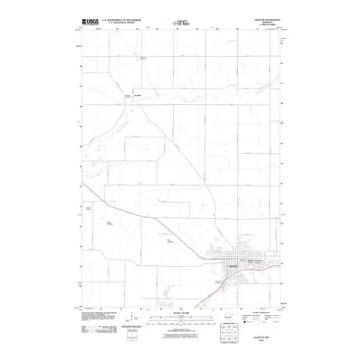
2010 Map of Glencoe
USGS Topo · Published 2010About this map
Glencoe serves as the primary urban center in this 2010 survey of McLeod County, situated near the confluence of local water systems. The town is anchored by the Glencoe Post Office and residential developments like Sunrise Court and Anderson Court. To the north, the small settlement of Koniska is defined by its relationship with the South Fork Crow River, which winds eastward through the agricultural landscape.
Find a feature on this map
47 named features on this map. Tap any name to fly to it.
Don’t see what you’re looking for? This feature index may not catch every label — zoom into the map to look around manually.
Map Details
Editions of this 2010 Glencoe Map
This is the sole edition of this map. No revisions or reprints were ever made.
Other maps of this area

1953 · New Ulm
USGS Topo · 1:250,000

1957 · New Ulm
USGS Topo · 1:250,000

1958 · New Ulm
USGS Topo · 1:250,000

1958 · Gaylord
USGS Topo · 1:62,500

1958 · Glencoe
USGS Topo · 1:62,500

1958 · Winthrop
USGS Topo · 1:62,500

1958 · Hutchinson
USGS Topo · 1:62,500

1967 · New Ulm
USGS Topo · 1:250,000
1982 · Silver Lake
USGS Topo · 1:24,000
1982 · Plato
USGS Topo · 1:24,000