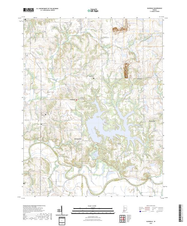
2022 Map of Glendale
USGS Topo · Published 2022About this map
East Fork White River defines the southern reach of this Daviess County landscape, winding past the notable elevation at High Rock. The area is characterized by a series of small, established rural settlements including Glendale, Hudsonville, and Corning, which are linked by an extensive network of county roads. Local history is anchored by numerous burial sites such as Saint Patricks Glencoe Cem and New Veale Creek Cem, reflecting generations of family settlement in the region. To the east, Dogwood Lake serves as a major hydrological feature, fed by tributaries like Mud Creek and surrounded by smaller water bodies like Big Piney Pond and Little Piney Pond. This survey illustrates a quiet agricultural and riverine economy where the boundaries of Daviess, Pike, and Dubois counties meet along the shifting course of the river.
Find a feature on this map
58 named features on this map. Tap any name to fly to it.
Don’t see what you’re looking for? This feature index may not catch every label — zoom into the map to look around manually.
Map Details
Editions of this 2022 Glendale Map
This is the sole edition of this map. No revisions or reprints were ever made.
Other maps of this area

1902 · Ditney
USGS Topo · 1:125,000

1903 · Velpen
USGS Topo · 1:62,500

1944 · Montgomery
USGS Topo · 1:24,000

1944 · Glendale
USGS Topo · 1:24,000

1944 · Washington
USGS Topo · 1:24,000

1945 · Sandy Hook
USGS Topo · 1:24,000

1946 · Jasper
USGS Topo · 1:24,000

1956 · Alfordsville
USGS Topo · 1:24,000

1956 · Loogootee
USGS Topo · 1:24,000

1956 · Vincennes
USGS Topo · 1:250,000