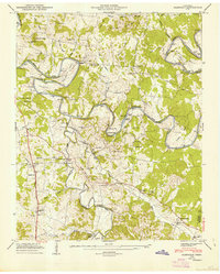
1947 Map of Glendale
USGS Topo · Published 1948About this map
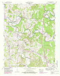
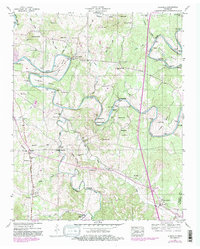
The winding Duck River carves a dramatic series of horseshoe bends across this Maury County landscape, including Cheek Bend and Sowell Bend, where the river's path dictated early infrastructure. The local economy and transport network of the late 1940s are visible in the Sowell Mill Pike and the Louisville & Nashville railroad corridor passing through Glendale. This 1947 field examination by the Tennessee Valley Authority documents a dense concentration of family history markers, particularly numerous small burial grounds such as Hull Cem and Vaughan Cem. Cultural life is anchored by rural institutions like the Union Grove Sch and Pleasant Mount Ch. The presence of several river crossings, including Sowell Ford and the Edmondson Bridge over Fountain Creek, highlights the historical importance of waterway navigation and management in middle Tennessee.
Find a feature on this map
71 named features on this map. Tap any name to fly to it.
Don’t see what you’re looking for? This feature index may not catch every label — zoom into the map to look around manually.
Map Details
Editions of this 1947 Glendale Map
6 editions found
Other maps of this area

1901 · Colombia
USGS Topo · 1:125,000

1936 · Godwin
USGS Topo · 1:24,000

1936 · Lewisburg
USGS Topo · 1:24,000

1936 · Verona
USGS Topo · 1:24,000

1936 · Campbells Station
USGS Topo · 1:24,000

1936 · Rally Hill
USGS Topo · 1:24,000

1936 · Carters Creek
USGS Topo · 1:24,000

1936 · Glendale
USGS Topo · 1:24,000

1936 · Columbia
USGS Topo · 1:24,000

1936 · Lynnville
USGS Topo · 1:24,000