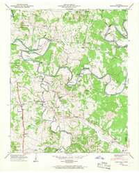
1947 Map of Glendale
USGS Topo · Published 1967About this map
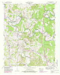
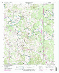
The Duck River carves a winding course through this Maury County landscape, defining the terrain with sharp bends like Cannon Bend and Vaughan Bend. The mid-century rural economy is evidenced by infrastructure along the water, including the Sowell Mill Bridge and Sowell Mill, alongside river crossings such as Sowell Ford. The map detail reveals a dense network of family history, noted through numerous private burial grounds such as Hardison Cem, Sowell Cem, and Rieves Cem.
Find a feature on this map
72 named features on this map. Tap any name to fly to it.
Don’t see what you’re looking for? This feature index may not catch every label — zoom into the map to look around manually.
Map Details
Editions of this 1947 Glendale Map
6 editions found
Other maps of this area

1901 · Colombia
USGS Topo · 1:125,000

1936 · Godwin
USGS Topo · 1:24,000

1936 · Lewisburg
USGS Topo · 1:24,000

1936 · Verona
USGS Topo · 1:24,000

1936 · Campbells Station
USGS Topo · 1:24,000

1936 · Rally Hill
USGS Topo · 1:24,000

1936 · Carters Creek
USGS Topo · 1:24,000

1936 · Glendale
USGS Topo · 1:24,000

1936 · Columbia
USGS Topo · 1:24,000

1936 · Lynnville
USGS Topo · 1:24,000