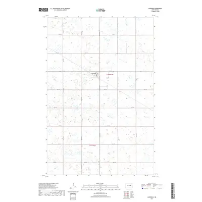
2017 Map of Glenfield
USGS Topo · Published 2017About this map
Glenfield occupies the center of this Foster County landscape, defined by a grid of agricultural section lines and township boundaries including t146n r62w and t145n r62w. The town plan is oriented around School Ave and Main St E, showing the concentrated residential and civic structure of this rural community. The surrounding terrain is heavily pocketed with wetlands and small water bodies, a characteristic prairie pothole environment typical of the region. Just east of the main settlement lies the Glenfield Cem, providing a focal point for genealogical research. The road network, including 5th St NE and 2nd SE, reflects the systematic 19th-century land surveys that shaped the development of North Dakota's farming districts.
Find a feature on this map
13 named features on this map. Tap any name to fly to it.
Don’t see what you’re looking for? This feature index may not catch every label — zoom into the map to look around manually.
Map Details
Editions of this 2017 Glenfield Map
This is the sole edition of this map. No revisions or reprints were ever made.
Other maps of this area
1900 · Pingree
USGS Topo · 1:125,000
1951 · Kensal
USGS Topo · 1:24,000
1951 · Kensal NW
USGS Topo · 1:24,000
1951 · Kensal SE
USGS Topo · 1:24,000
1951 · Glenfield
USGS Topo · 1:24,000
1952 · New Rockford
USGS Topo · 1:250,000
1956 · New Rockford
USGS Topo · 1:250,000
1961 · McHenry
USGS Topo · 1:24,000
1961 · Juanita
USGS Topo · 1:24,000
1961 · Sutton
USGS Topo · 1:24,000