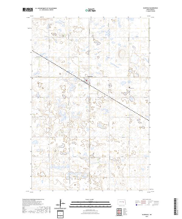
2024 Map of Glenfield
USGS Topo · Published 2024About this map
Glenfield serves as the central hub of this Foster County landscape, characterized by a distinct grid of agricultural roads and numerous seasonal wetlands. The town's layout is clearly defined by local thoroughfares such as School Ave and Main St E, providing a detailed look at the rural settlement pattern in this part of North Dakota. To the east of the primary residential area lies the Glenfield Cem, a significant site for those researching local family history and genealogy. The surrounding terrain is heavily marked by small water bodies and marshes, illustrating the prairie pothole geography of the region. The map also delineates the township boundaries between t146n r62w and t145n r62w, which guide the orientation of the section lines and the local road network.
Find a feature on this map
13 named features on this map. Tap any name to fly to it.
Don’t see what you’re looking for? This feature index may not catch every label — zoom into the map to look around manually.
Map Details
Editions of this 2024 Glenfield Map
This is the sole edition of this map. No revisions or reprints were ever made.
Other maps of this area

1900 · Pingree
USGS Topo · 1:125,000

1951 · Kensal
USGS Topo · 1:24,000

1951 · Kensal NW
USGS Topo · 1:24,000

1951 · Kensal SE
USGS Topo · 1:24,000

1951 · Glenfield
USGS Topo · 1:24,000

1952 · New Rockford
USGS Topo · 1:250,000

1956 · New Rockford
USGS Topo · 1:250,000

1961 · McHenry
USGS Topo · 1:24,000
1961 · Juanita
USGS Topo · 1:24,000

1961 · Sutton
USGS Topo · 1:24,000