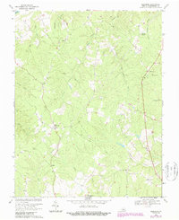
1968 Map of Glenmore
USGS Topo · Published 1987About this map
Glenmore and the surrounding central Virginia countryside are defined by a dense network of watercourses and rural community landmarks. Located in Buckingham County, the landscape is deeply etched by Rock Island Creek, Fallsburg Creek, and Muddy Creek as they trend toward the James River. This late-1960s perspective reveals a territory rooted in small settlements like Axtell and Centenary, where social life centered on country churches such as Salem Ch, Emmanuel Ch, and Alexandria Ch. The map captures a moment when traditional rural infrastructure, including Paynes Millpond, coexisted with modern additions like the local Landing Strip and natural gas Pipelines. Genealogists will find a wealth of family history data in the numerous unnamed Cemeteries scattered across the uplands near Camm and Ransons.
Find a feature on this map
30 named features on this map. Tap any name to fly to it.
Don’t see what you’re looking for? This feature index may not catch every label — zoom into the map to look around manually.
Map Details
Editions of this 1968 Glenmore Map
2 editions found
Other maps of this area

1891 · Palmyra
USGS Topo · 1:125,000

1892 · Buckingham
USGS Topo · 1:125,000

1895 · Palmyra
USGS Topo · 1:125,000

1897 · Palmyra
USGS Topo · 1:125,000

1929 · Covesville
USGS Topo · 1:62,500

1935 · Covesville
USGS Topo · 1:62,500

1943 · Scottsville
USGS Topo · 1:62,500

1945 · Covesville
USGS Topo · 1:62,500

1946 · Scottsville
USGS Topo · 1:62,500

1947 · Roanoke
USGS Topo · 1:250,000