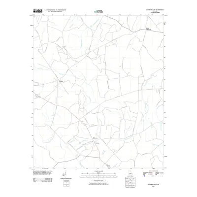
2011 Map of Glennville SE
USGS Topo · Published 2011About this map
Macedonia Cemetery and the settlement of Donald define the rural character of this Long County landscape in the early 21st century. The map reveals a dispersed settlement pattern typical of the Georgia coastal plain, where family-named roads like Tommie Hines Rd and Lamar Berry Rd connect small communities. A network of low-lying waterways, including Jones Creek, Doctors Creek, and Old Millhead Branch, creates a distinctive dendritic pattern across the terrain. Of particular interest to researchers is the Fletcher Branch Lookout Tower situated near Wefanie, marking a site of regional fire management. The intersection at Smiley Crossroads serves as a local hub, where Moody Rd and County Rd 57 meet, illustrating the continued importance of these historical crossroads as navigation points in the modern era.
Find a feature on this map
52 named features on this map. Tap any name to fly to it.
Don’t see what you’re looking for? This feature index may not catch every label — zoom into the map to look around manually.
Map Details
Editions of this 2011 Glennville SE Map
This is the sole edition of this map. No revisions or reprints were ever made.
Other maps of this area

1918 · Jesup
USGS Topo · 1:62,500

1918 · Hinesville
USGS Topo · 1:62,500

1920 · Glennville
USGS Topo · 1:62,500

1943 · Ludowici
USGS Topo · 1:62,500

1943 · Jesup
USGS Topo · 1:62,500

1944 · Glennville
USGS Topo · 1:62,500

1944 · Hinesville
USGS Topo · 1:62,500

1946 · Brunswick
USGS Topo · 1:250,000

1948 · Brunswick
USGS Topo · 1:250,000

1950 · Glennville
USGS Topo · 1:62,500