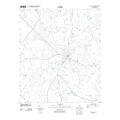
2011 Map of Glennville
USGS Topo · Published 2011About this map
Glennville serves as the central hub of this South Georgia landscape, situated at a crossroads of agriculture and hydrology in Tattnall County. The topography is defined by an intricate network of waterways and ponds, such as Kicklighters Pond and Stricklands Pond, which feed into major drainages like Beards Creek and Watermelon Creek. These water sources historically supported local industry, evidenced by features like Brewton Millpond and Edwards Millpond. Rural life is anchored by smaller communities including Mendes and Lynn, while the presence of the Glennville Post Office indicates the town's role as a regional service center.
Find a feature on this map
98 named features on this map. Tap any name to fly to it.
Don’t see what you’re looking for? This feature index may not catch every label — zoom into the map to look around manually.
Map Details
Editions of this 2011 Glennville Map
This is the sole edition of this map. No revisions or reprints were ever made.
Other maps of this area

1919 · Claxton
USGS Topo · 1:62,500

1920 · Glennville
USGS Topo · 1:62,500

1944 · Claxton
USGS Topo · 1:62,500

1944 · Glennville
USGS Topo · 1:62,500

1946 · Brunswick
USGS Topo · 1:250,000

1947 · Savannah
USGS Topo · 1:250,000

1948 · Brunswick
USGS Topo · 1:250,000

1948 · Savannah
USGS Topo · 1:250,000

1950 · Glennville
USGS Topo · 1:62,500

1950 · Claxton
USGS Topo · 1:62,500