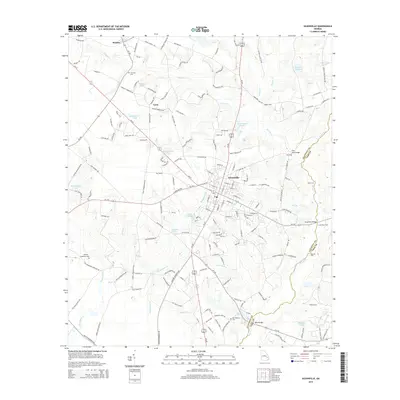
2014 Map of Glennville
USGS Topo · Published 2014About this map
Glennville serves as the central hub of this coastal plain landscape, where the agricultural and social history of Tattnall County is etched into the road network. The map reveals a high concentration of water features essential to local life, including Brewton Millpond, Edwards Millpond, and Kicklighters Pond. The rural character of the area is further defined by smaller settlements such as Mendes and Lynn, which are connected by a web of family-named routes like Pratt Bacon Rd and Leland Dasher Rd. Genealogists will find several burial grounds across the terrain, including Surrency Cem, Bradley - Anderson Cem, and Old Halltown Cem. Along the eastern edge, the winding course of Beards Creek forms the boundary between Tattnall and Long counties, crossed by landmarks like the Flat Ford Bridge.
Find a feature on this map
162 named features on this map. Tap any name to fly to it.
Don’t see what you’re looking for? This feature index may not catch every label — zoom into the map to look around manually.
Map Details
Editions of this 2014 Glennville Map
This is the sole edition of this map. No revisions or reprints were ever made.
Other maps of this area

1919 · Claxton
USGS Topo · 1:62,500

1920 · Glennville
USGS Topo · 1:62,500

1944 · Claxton
USGS Topo · 1:62,500

1944 · Glennville
USGS Topo · 1:62,500

1946 · Brunswick
USGS Topo · 1:250,000

1947 · Savannah
USGS Topo · 1:250,000

1948 · Brunswick
USGS Topo · 1:250,000

1948 · Savannah
USGS Topo · 1:250,000

1950 · Glennville
USGS Topo · 1:62,500

1950 · Claxton
USGS Topo · 1:62,500