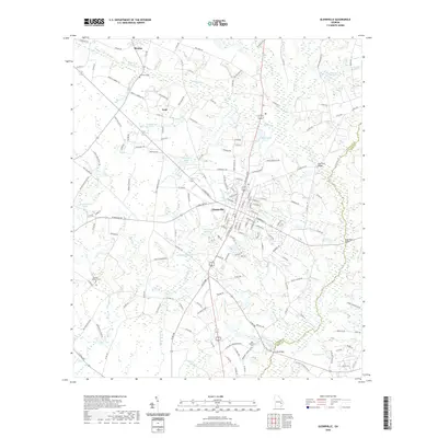
2020 Map of Glennville
USGS Topo · Published 2020About this map
Glennville serves as the central hub of this modern survey, where the street grid is defined by a network of local roads and intersections leading toward smaller settlements like Mendes and Lynn. The landscape is characterized by its agricultural and forested layout, punctuated by numerous named water features such as Edwards Millpond and the complex drainage of Watermelon Cr and Mushmelon Cr.
Find a feature on this map
162 named features on this map. Tap any name to fly to it.
Don’t see what you’re looking for? This feature index may not catch every label — zoom into the map to look around manually.
Map Details
Editions of this 2020 Glennville Map
This is the sole edition of this map. No revisions or reprints were ever made.
Other maps of this area

1919 · Claxton
USGS Topo · 1:62,500

1920 · Glennville
USGS Topo · 1:62,500

1944 · Claxton
USGS Topo · 1:62,500

1944 · Glennville
USGS Topo · 1:62,500

1946 · Brunswick
USGS Topo · 1:250,000

1947 · Savannah
USGS Topo · 1:250,000

1948 · Brunswick
USGS Topo · 1:250,000

1948 · Savannah
USGS Topo · 1:250,000

1950 · Glennville
USGS Topo · 1:62,500

1950 · Claxton
USGS Topo · 1:62,500