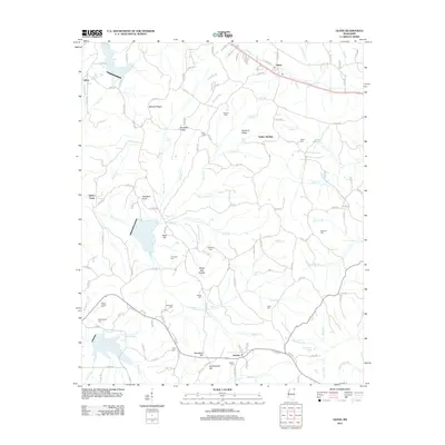
2012 Map of Glens
USGS Topo · Published 2012About this map
Jacinto stands as a focal point in this portion of Alcorn County, situated at the southern edge of a landscape defined by ridges and spring-fed creek systems. The area is characterized by several distinct high points including Bennett Ridge, Winbush Ridge, and Bloodsaw Hill, which separate the various drainages that feed into Coke Cr and Boone Cr. A dense concentration of family and community burial sites, such as Arbor Cem, Johns Cem, and McWilliams Cem, offers significant detail for genealogical research into the local heritage of this Mississippi region.
Find a feature on this map
149 named features on this map. Tap any name to fly to it.
Don’t see what you’re looking for? This feature index may not catch every label — zoom into the map to look around manually.
Map Details
Editions of this 2012 Glens Map
This is the sole edition of this map. No revisions or reprints were ever made.
Other maps of this area

1921 · Booneville
USGS Topo · 1:48,000

1922 · Booneville
USGS Topo · 1:62,500

1935 · Holcut
USGS Topo · 1:24,000

1935 · Doskie
USGS Topo · 1:24,000

1935 · Leedy
USGS Topo · 1:24,000

1935 · Glens
USGS Topo · 1:24,000

1936 · Kendrick
USGS Topo · 1:24,000

1950 · Corinth
USGS Topo · 1:62,500

1950 · Kendrick
USGS Topo · 1:24,000

1950 · Paden
USGS Topo · 1:24,000