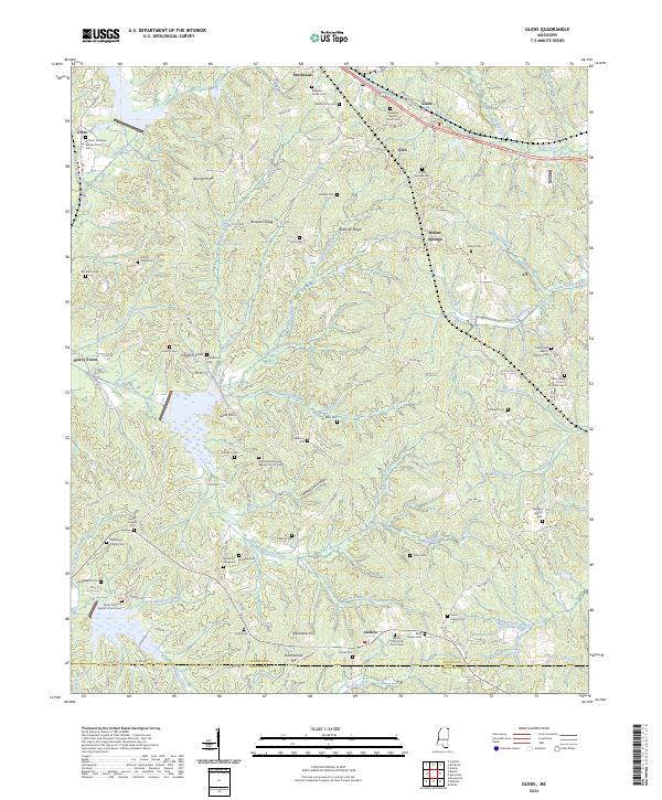
2024 Map of Glens
USGS Topo · Published 2024About this map
Jacinto and its historic surroundings near the Alcorn and Prentiss county line reveal a landscape deeply marked by early Mississippi settlement and religious life. This area is exceptionally dense with family graveyards and church-affiliated burial grounds, including the Boshers Graveyard, Stephens Family Cem, and the Sardis Primitive Baptist Church Cem. The terrain is defined by a series of parallel ridges like Bennett Ridge and Winbush Ridge, which directed early road development and farm placement. The convergence of Coke Creek and Clear Creek in the north near Glens provides a clear view of the water network that supported the rural economy of settlements like Indian Springs and Searcy Town. The map serves as a vital record for genealogists tracing ancestral families through sites like Choate's Acre Cem and Malone Cem.
Find a feature on this map
90 named features on this map. Tap any name to fly to it.
Don’t see what you’re looking for? This feature index may not catch every label — zoom into the map to look around manually.
Map Details
Editions of this 2024 Glens Map
This is the sole edition of this map. No revisions or reprints were ever made.
Other maps of this area

1921 · Booneville
USGS Topo · 1:48,000

1922 · Booneville
USGS Topo · 1:62,500

1935 · Holcut
USGS Topo · 1:24,000

1935 · Doskie
USGS Topo · 1:24,000

1935 · Leedy
USGS Topo · 1:24,000

1935 · Glens
USGS Topo · 1:24,000

1936 · Kendrick
USGS Topo · 1:24,000

1950 · Corinth
USGS Topo · 1:62,500

1950 · Kendrick
USGS Topo · 1:24,000

1950 · Paden
USGS Topo · 1:24,000