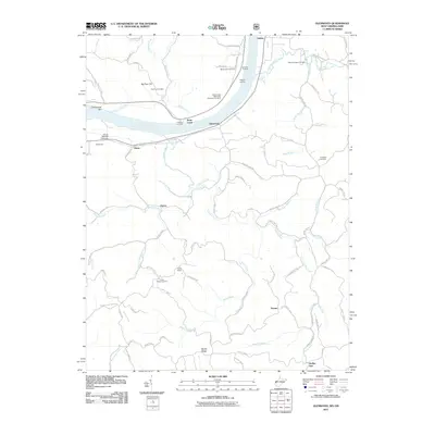
2011 Map of Glenwood
USGS Topo · Published 2011About this map
The Ohio River dominates this 2011 survey, serving as a primary corridor for small river settlements and landings. Along its banks, places like Glenwood, McFanns Landing, and Waughs Landing indicate a long-standing reliance on the waterway for transport and trade. The landscape is defined by the winding paths of Guyan Creek and Bryan Creek, which carve through the terrain toward the river. Historically significant burial sites are scattered throughout the hills, including the Swan Creek Methodist Episcopal Cemetery and Big Four Cemetery near Big Four Hill. Further inland, the small communities of Gwinn, Union Ridge, and Clover are linked by a network of county roads, including the Hannan Trace Rd, reflecting a rural settlement pattern that persists into the 21st century. The Clover Railroad Overpass stands as a notable structural feature where rail and road infrastructure intersect near the river's edge.
Find a feature on this map
88 named features on this map. Tap any name to fly to it.
Don’t see what you’re looking for? This feature index may not catch every label — zoom into the map to look around manually.
Map Details
Editions of this 2011 Glenwood Map
This is the sole edition of this map. No revisions or reprints were ever made.
Other maps of this area

1892 · Huntington
USGS Topo · 1:125,000

1898 · Huntington
USGS Topo · 1:125,000

1901 · Guyandot
USGS Topo · 1:62,500

1902 · Guyandot
USGS Topo · 1:62,500

1902 · Milton
USGS Topo · 1:62,500

1906 · Athalia
USGS Topo · 1:62,500

1906 · Glenwood
USGS Topo · 1:62,500

1908 · Athalia
USGS Topo · 1:62,500

1908 · Glenwood
USGS Topo · 1:62,500

1931 · Milton
USGS Topo · 1:62,500