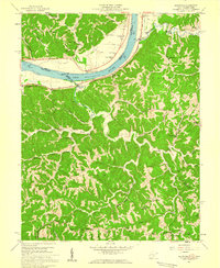
1958 Map of Glenwood
USGS Topo · Published 1959About this map
The Ohio River shoreline defines the western edge of this 1958 survey, where the Baltimore and Ohio railroad tracks follow the river's bend past settlements like Glenwood and Ashton. Moving inland, the landscape rises into the ridges of Hannan and Union districts, where a network of rural schools and churches anchored small communities. Facilities such as Beech Grove Sch and Meadowfield Sch are positioned along the winding creek beds and narrow ridges. Local landmarks like Barker Ridge and Union Ridge reflect the agricultural and residential patterns of the mid-20th century in this portion of Cabell and Mason counties. Small family and community gatherings are evidenced by numerous Cem markings and houses of worship like Swan Creek Ch and Moores Chapel, documenting a persistent rural life along the West Virginia and Ohio border.
Find a feature on this map
66 named features on this map. Tap any name to fly to it.
Don’t see what you’re looking for? This feature index may not catch every label — zoom into the map to look around manually.
Map Details
Editions of this 1958 Glenwood Map
2 editions found
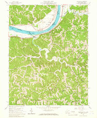
Other maps of this area

1892 · Huntington
USGS Topo · 1:125,000

1898 · Huntington
USGS Topo · 1:125,000

1901 · Guyandot
USGS Topo · 1:62,500

1902 · Guyandot
USGS Topo · 1:62,500

1902 · Milton
USGS Topo · 1:62,500

1906 · Athalia
USGS Topo · 1:62,500

1906 · Glenwood
USGS Topo · 1:62,500

1908 · Athalia
USGS Topo · 1:62,500

1908 · Glenwood
USGS Topo · 1:62,500

1931 · Milton
USGS Topo · 1:62,500