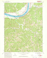
1968 Map of Glenwood
USGS Topo · Published 1969About this map
The Ohio River shoreline, marked by the Baltimore and Ohio railroad corridor, forms the northern border of this West Virginia study. Inland from the river at Glenwood, the terrain is defined by the deep valleys of Guyan Creek and Spurlock Creek, where a network of ridge-top settlements and rural institutions supported local families. Small communities like Union Ridge and Swann are anchored by landmarks such as Union Chapel and the Union Ridge Cem. Higher ground along Barker Ridge and Hannan shows a dense concentration of community centers, including Central Sch, Lawrence Chapel, and several other small schoolhouses. This era of the landscape is characterized by the tension between the riverfront industry, represented by a Gravel Pit and the main rail line, and the more traditional upland agricultural life found along Swan Creek Rd and Stewart Rd.
Find a feature on this map
77 named features on this map. Tap any name to fly to it.
Don’t see what you’re looking for? This feature index may not catch every label — zoom into the map to look around manually.
Map Details
Editions of this 1968 Glenwood Map
2 editions found
Other maps of this area

1892 · Huntington
USGS Topo · 1:125,000

1898 · Huntington
USGS Topo · 1:125,000

1901 · Guyandot
USGS Topo · 1:62,500

1902 · Guyandot
USGS Topo · 1:62,500

1902 · Milton
USGS Topo · 1:62,500

1906 · Athalia
USGS Topo · 1:62,500

1906 · Glenwood
USGS Topo · 1:62,500

1908 · Athalia
USGS Topo · 1:62,500

1908 · Glenwood
USGS Topo · 1:62,500

1931 · Milton
USGS Topo · 1:62,500