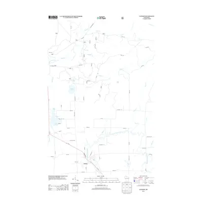
2013 Map of Glidden
USGS Topo · Published 2013About this map
Glidden serves as the primary settlement on this landscape, positioned where the East Fork Chippewa River begins its winding course southward. The geography is defined by a dense network of tributaries and glacial lakes, including Summit Lake, Gordon Lake, and Wolf Lake, which illustrate the post-glacial hydrography of northern Wisconsin. While the southern portion of the map near Marian Park shows a more organized grid of local roads like Cemetery Rd and Mill Rd, the northern reaches are dominated by the upper stretches of the Bad River and its feeder streams like Spillerberg Creek. The distribution of family-named roads such as Charles Wolf Rd and Prieb Rd suggests a history of localized land ownership and rural development centered around the river systems and small lake basins.
Find a feature on this map
61 named features on this map. Tap any name to fly to it.
Don’t see what you’re looking for? This feature index may not catch every label — zoom into the map to look around manually.
Map Details
Editions of this 2013 Glidden Map
This is the sole edition of this map. No revisions or reprints were ever made.
Other maps of this area

1940 · Butternut
USGS Topo · 1:48,000

1940 · Upson
USGS Topo · 1:48,000

1942 · Glidden
USGS Topo · 1:48,000

1942 · Mellen
USGS Topo · 1:48,000

1943 · Upson
USGS Topo · 1:48,000

1945 · Glidden
USGS Topo · 1:48,000

1945 · Mellen
USGS Topo · 1:48,000

1947 · Butternut
USGS Topo · 1:48,000

1950 · Butternut
USGS Topo · 1:48,000

1953 · Ashland
USGS Topo · 1:250,000