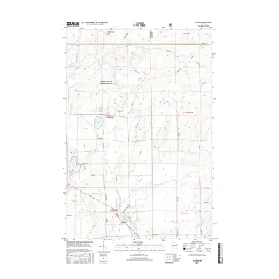
2015 Map of Glidden
USGS Topo · Published 2015About this map
Glidden serves as the primary settlement on this northern Wisconsin map, situated where the East Fork Chippewa River begins its course through the southern half of the quadrangle. The town's grid is clearly defined by streets such as Broadway, N Mill RD, and E 2nd ST, with the Mount Hope Cem located just to the north. This area marks a significant hydrological divide, where waters flow toward both the Mississippi River system and Lake Superior.
Find a feature on this map
66 named features on this map. Tap any name to fly to it.
Don’t see what you’re looking for? This feature index may not catch every label — zoom into the map to look around manually.
Map Details
Editions of this 2015 Glidden Map
This is the sole edition of this map. No revisions or reprints were ever made.
Other maps of this area

1940 · Butternut
USGS Topo · 1:48,000

1940 · Upson
USGS Topo · 1:48,000

1942 · Glidden
USGS Topo · 1:48,000

1942 · Mellen
USGS Topo · 1:48,000

1943 · Upson
USGS Topo · 1:48,000

1945 · Glidden
USGS Topo · 1:48,000

1945 · Mellen
USGS Topo · 1:48,000

1947 · Butternut
USGS Topo · 1:48,000

1950 · Butternut
USGS Topo · 1:48,000

1953 · Ashland
USGS Topo · 1:250,000