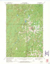
1968 Map of Glidden
USGS Topo · Published 1971About this map
The Soo Line railroad forms a vital transport spine through the Wisconsin Northwoods in this late 1960s study, connecting the timber-rich landscape between Glidden and Cayuga. This region of Ashland and Iron counties is defined by its complex hydrologic network, where the headwaters of the Bad River flow north while the East Fork of the Chippewa River drains toward the south. The settlement of Shanagolden and the curiously named Popcorn Corners reflect the localized rural development typical of the era, supported by small-scale resource extraction evidenced by numerous Gravel Pits scattered near the rail line.
Find a feature on this map
59 named features on this map. Tap any name to fly to it.
Don’t see what you’re looking for? This feature index may not catch every label — zoom into the map to look around manually.
Map Details
Editions of this 1968 Glidden Map
This is the sole edition of this map. No revisions or reprints were ever made.
Other maps of this area

1940 · Butternut
USGS Topo · 1:48,000

1940 · Upson
USGS Topo · 1:48,000

1941 · Park Falls
USGS Topo · 1:48,000

1941 · Kennedy
USGS Topo · 1:48,000

1942 · Glidden
USGS Topo · 1:48,000

1942 · Clam Lake
USGS Topo · 1:48,000

1942 · Mellen
USGS Topo · 1:48,000

1942 · Marengo
USGS Topo · 1:48,000

1943 · Upson
USGS Topo · 1:48,000

1943 · Park Falls
USGS Topo · 1:48,000