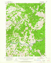
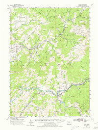
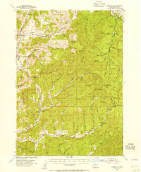
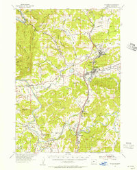
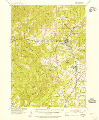
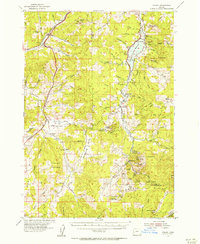
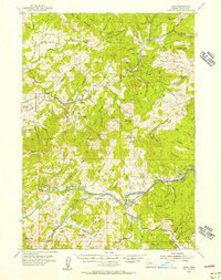
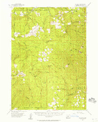
1954 Map of Glide
USGS Topo · Published 1964About this map
The North Fork Umpqua River carves a winding path through this mid-century landscape, centered on the community of Glide. The map documents a rugged timber-and-agricultural economy, indicated by the presence of a Logging RR and the Rock Creek Fish Hatchery in the eastern reach of the quadrangle. Settlements like English Settlement and Nonpareil are situated along the valley floors, where the terrain breaks between prominent elevations such as Scott Mtn and Watson Mtn. Local infrastructure of the era is preserved in details like the Footbridge and Gaging Sta near Idleyld Park. The distribution of Cem sites and smaller place names like Peel and Fairoaks provides a foundational layout for those researching the early family footprints and rural development of Douglas County before modern expansion.
Find a feature on this map
82 named features on this map. Tap any name to fly to it.
Don’t see what you’re looking for? This feature index may not catch every label — zoom into the map to look around manually.
Map Details
Editions of this 1954 Glide Map
3 editions found
Other maps of this area

1897 · Roseburg
USGS Topo · 1:125,000

1900 · Roseburg
USGS Topo · 1:125,000

1935 · Lowell
USGS Topo · 1:96,000

1942 · Lowell
USGS Topo · 1:125,000
1954 · Dixonville
USGS Topo · 1:62,500
1954 · Sutherlin
USGS Topo · 1:62,500
1954 · Drain
USGS Topo · 1:62,500
1954 · Anlauf
USGS Topo · 1:62,500
1954 · Glide
USGS Topo · 1:62,500
1955 · Red Butte
USGS Topo · 1:62,500