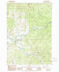
1987 Map of Glide
USGS Topo · Published 1987About this map
North Umpqua River and the Little River converge near the settlement of Glide, defining the geography of this Douglas County region in the late 20th century. The landscape is characterized by its reliance on the river systems and forest management, evidenced by the Glide Ranger Station and the Rock Creek Fish Hatchery located near The Narrows. Higher elevations are marked by landmarks like Scott Mountain, which features a Lookout Tower, and Ace Williams Mountain to the southeast.
Find a feature on this map
45 named features on this map. Tap any name to fly to it.
Don’t see what you’re looking for? This feature index may not catch every label — zoom into the map to look around manually.
Map Details
Editions of this 1987 Glide Map
2 editions found
Other maps of this area

1897 · Roseburg
USGS Topo · 1:125,000

1900 · Roseburg
USGS Topo · 1:125,000

1954 · Dixonville
USGS Topo · 1:62,500

1954 · Glide
USGS Topo · 1:62,500

1955 · Red Butte
USGS Topo · 1:62,500

1955 · Mace Mtn
USGS Topo · 1:62,500

1958 · Roseburg
USGS Topo · 1:250,000

1959 · Roseburg
USGS Topo · 1:250,000

1978 · Diamond Lake
USGS Topo · 1:100,000

1979 · Roseburg
USGS Topo · 1:100,000