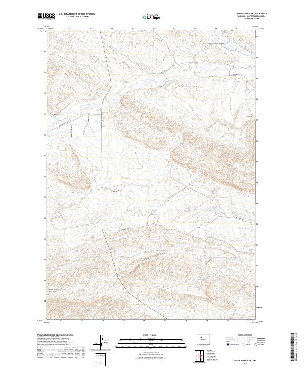
2021 Map of Gloin Reservoir
USGS Topo · Published 2021About this map
Gloin Reservoir sits at the center of this drainage network in Hot Springs County, where the high desert landscape is defined by its seasonal watercourses and complex relief. The hydrological pattern is dominated by Cottonwood Cr and Grass Cr in the north, while the southern terrain is carved by the deep incisions of Sand Draw and North Fork Coal Draw. This territory is primarily navigated via a sparse network of unpaved access ways, including Lower Cottonwood Creek Rd and Little Sand Draw Rd, which follow the natural contours of the drainages. The map reveals a transition from the narrow valley of Prospect Cr to the more expansive basins where water is managed for livestock or local use in this arid portion of Wyoming. The absence of traditional settlements emphasizes the utilitarian nature of the land, focusing on grazing rights and water management within the Public Land Survey System.
Find a feature on this map
15 named features on this map. Tap any name to fly to it.
Don’t see what you’re looking for? This feature index may not catch every label — zoom into the map to look around manually.
Map Details
Editions of this 2021 Gloin Reservoir Map
This is the sole edition of this map. No revisions or reprints were ever made.
Other maps of this area

1913 · Grass Creek Basin
USGS Topo · 1:62,500

1914 · Blue Mesa
USGS Topo · 1:62,500

1915 · Grass Creek Basin
USGS Topo · 1:62,500

1916 · Blue Mesa
USGS Topo · 1:62,500

1955 · Thermopolis
USGS Topo · 1:250,000

1958 · Thermopolis
USGS Topo · 1:250,000

1962 · Thermopolis
USGS Topo · 1:250,000

1965 · Arapahoe Ranch
USGS Topo · 1:24,000
1965 · Thompson Reservoirs
USGS Topo · 1:24,000
1965 · Rattlesnake Gulch
USGS Topo · 1:24,000