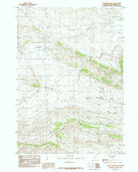
1985 Map of Gloin Reservoir
USGS Topo · Published 1985About this map
Gloin Reservoir sits at the heart of this high-plains landscape in Hot Springs County, where intricate drainage patterns define the territory. The map reveals a network of seasonal watercourses and topographic features like The Narrows and Wagon Gulch that dictate the movement across this arid terrain. Sparse human presence is indicated by a utility Substa and various unnamed Prospects, suggesting the area's primary value for energy resources and grazing.
Find a feature on this map
12 named features on this map. Tap any name to fly to it.
Don’t see what you’re looking for? This feature index may not catch every label — zoom into the map to look around manually.
Map Details
Editions of this 1985 Gloin Reservoir Map
This is the sole edition of this map. No revisions or reprints were ever made.
Other maps of this area

1913 · Grass Creek Basin
USGS Topo · 1:62,500

1914 · Blue Mesa
USGS Topo · 1:62,500

1915 · Grass Creek Basin
USGS Topo · 1:62,500

1916 · Blue Mesa
USGS Topo · 1:62,500

1955 · Thermopolis
USGS Topo · 1:250,000

1958 · Thermopolis
USGS Topo · 1:250,000

1962 · Thermopolis
USGS Topo · 1:250,000

1965 · Arapahoe Ranch
USGS Topo · 1:24,000
1965 · Thompson Reservoirs
USGS Topo · 1:24,000
1965 · Rattlesnake Gulch
USGS Topo · 1:24,000