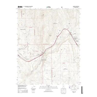
2013 Map of Glorieta
USGS Topo · Published 2013About this map
Glorieta Pass serves as the focal point of this high-altitude landscape, where the terrain transitions from the rugged heights of Shaggy Peak down to the sprawling Glorieta Mesa. The map captures a region deeply marked by both natural barriers and human transit, illustrated by the convergence of modern interchanges and the older routes through Apache Canyon. Notable historical sites are clearly delineated, including the Glorieta Battlefield National Historic Landmark and portions of the Pecos National Historical Park. Smaller settlements and family landholdings such as Cañada de los Alamos, Garcia Ranch, and Romero Ranch are scattered across the Santa Fe National Forest. For genealogists and local historians, the presence of the Glorieta Cem and Cañoncito Cem, along with the Cañoncito Siding railroad feature, provides specific points of interest for tracing early New Mexico settlement patterns.
Find a feature on this map
78 named features on this map. Tap any name to fly to it.
Don’t see what you’re looking for? This feature index may not catch every label — zoom into the map to look around manually.
Map Details
Editions of this 2013 Glorieta Map
This is the sole edition of this map. No revisions or reprints were ever made.
Other maps of this area

1889 · Santa Fe
USGS Topo · 1:125,000

1894 · Santa Fe
USGS Topo · 1:125,000

1894 · Lamy
USGS Topo · 1:125,000

1952 · Santa Fe
USGS Topo · 1:24,000

1952 · Seton Village
USGS Topo · 1:24,000

1953 · Glorieta
USGS Topo · 1:24,000

1953 · Mc Clure Reservoir
USGS Topo · 1:24,000

1954 · Santa Fe
USGS Topo · 1:250,000

1958 · Santa Fe
USGS Topo · 1:250,000
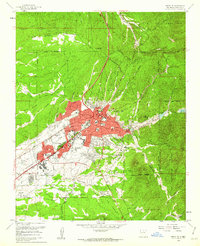
1961 · Santa Fe
USGS Topo · 1:24,000