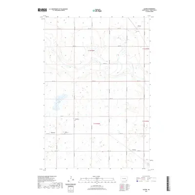
2020 Map of Glover
USGS Topo · Published 2020About this map
The James River meanders across this Dickey County landscape, defining the topography near the small settlement of Glover. This prairie region is characterized by its agricultural grid and scattered water features like Stevens Slough, which dominates the western portion of the terrain. Local history is anchored by several rural landmarks, including the Glover Cem and Our Saviors Lutheran Cem, serving as physical records of the families who settled this part of North Dakota. In the southern half of the quadrangle, the community of Clement sits at the junction of 103rd Ave SE and 87th St SE, while Norway and the nearby Norway Pioneer Cem reflect the area’s cultural heritage. The map's layout of section lines and gravel roads reveals a deeply rooted rural infrastructure established long before this modern survey.
Find a feature on this map
26 named features on this map. Tap any name to fly to it.
Don’t see what you’re looking for? This feature index may not catch every label — zoom into the map to look around manually.
Map Details
Editions of this 2020 Glover Map
This is the sole edition of this map. No revisions or reprints were ever made.
Other maps of this area

1894 · La Moure
USGS Topo · 1:62,500

1894 · Fullerton
USGS Topo · 1:62,500

1894 · Oakes
USGS Topo · 1:62,500

1895 · Lamoure
USGS Topo · 1:125,000

1918 · La Moure
USGS Topo · 1:125,000

1952 · Glover
USGS Topo · 1:24,000

1952 · Oakes
USGS Topo · 1:24,000

1952 · Independence
USGS Topo · 1:24,000

1953 · Jamestown
USGS Topo · 1:250,000
1955 · Oakes SE
USGS Topo · 1:24,000