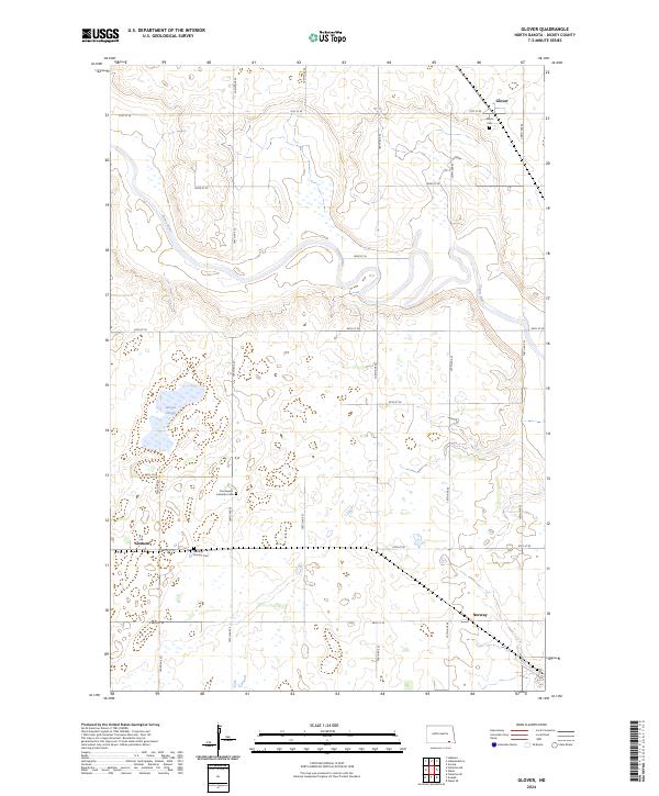
2024 Map of Glover
USGS Topo · Published 2024About this map
The winding James River defines the upper portion of this Dickey County landscape, where the small settlements of Glover and Clement serve as the primary hubs. This prairie terrain is dotted with seasonal wetlands and protected habitats, most notably the Dickey County Waterfowl Production Area and Stevens Slough. For genealogists and local historians, the map preserves the locations of several burial grounds, including the Norway Pioneer Cem and Our Saviors Lutheran Cem, which indicate the early pioneer presence and cultural roots of the Norway vicinity. The grid-like layout of roads such as 104th Ave SE and 87th St SE provides a clear structure for tracking early 21st-century land divisions and the placement of historic farmsteads.
Find a feature on this map
28 named features on this map. Tap any name to fly to it.
Don’t see what you’re looking for? This feature index may not catch every label — zoom into the map to look around manually.
Map Details
Editions of this 2024 Glover Map
This is the sole edition of this map. No revisions or reprints were ever made.
Other maps of this area

1894 · La Moure
USGS Topo · 1:62,500

1894 · Fullerton
USGS Topo · 1:62,500

1894 · Oakes
USGS Topo · 1:62,500

1895 · Lamoure
USGS Topo · 1:125,000

1918 · La Moure
USGS Topo · 1:125,000

1952 · Glover
USGS Topo · 1:24,000

1952 · Oakes
USGS Topo · 1:24,000

1952 · Independence
USGS Topo · 1:24,000

1953 · Jamestown
USGS Topo · 1:250,000
1955 · Oakes SE
USGS Topo · 1:24,000