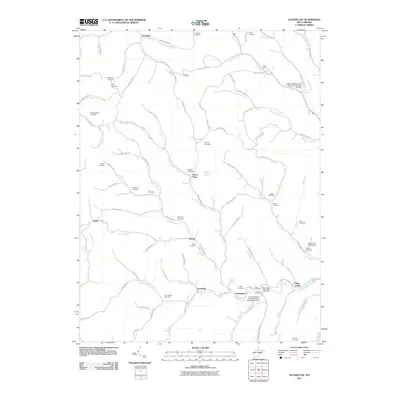
2011 Map of Glover Gap
USGS Topo · Published 2011About this map
Logansport and Curtisville anchor the southern portion of this landscape, where the waters of Buffalo Creek and Owen Davy Fork converge. The terrain is defined by a dense network of hollows and runs, including Bartholomew Fork and Warrior Fork, which historically dictated the placement of small settlements and family farmsteads. This 2011 survey reveals an exceptionally high density of small family and community burial grounds, such as Snodgrass Cemetery, Atha Cemetery, and Rymer Cemetery, reflecting generations of local lineage in this part of Marion County.
Find a feature on this map
112 named features on this map. Tap any name to fly to it.
Don’t see what you’re looking for? This feature index may not catch every label — zoom into the map to look around manually.
Map Details
Editions of this 2011 Glover Gap Map
This is the sole edition of this map. No revisions or reprints were ever made.
Other maps of this area

1902 · Clarksburg
USGS Topo · 1:62,500

1903 · Littleton
USGS Topo · 1:62,500

1905 · Mannington
USGS Topo · 1:62,500

1905 · Centerpoint
USGS Topo · 1:62,500

1905 · Littleton
USGS Topo · 1:62,500

1910 · Clarksburg
USGS Topo · 1:62,500

1923 · Mannington
USGS Topo · 1:62,500

1923 · Clarksburg
USGS Topo · 1:62,500

1924 · Centerpoint
USGS Topo · 1:62,500

1924 · Littleton
USGS Topo · 1:62,500