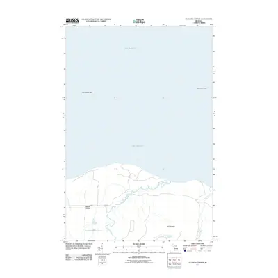
2011 Map of Glovers Corner
USGS Topo · Published 2011About this map
Glovers Corner serves as the focal point of this coastal landscape along the southern shores of Lake Superior. The area is defined by the convergence of the Huron River and Little Huron River, which wind through the terrain before reaching the Great Lake. Near the shoreline, maritime features like Point Abbaye Reef and Lighthouse Island indicate the navigational complexities of the coastline. Inland, the topography rises toward Bald Mountain, while a network of named local roads like Swanberg, Roth, and Portice suggests the footprints of family settlements and rural homesteads in Arvon Township. The presence of Gulskoog Creek and Ward road further illustrates the sparse but established drainage and transit patterns characteristic of this part of the Upper Peninsula.
Find a feature on this map
15 named features on this map. Tap any name to fly to it.
Don’t see what you’re looking for? This feature index may not catch every label — zoom into the map to look around manually.
Map Details
Editions of this 2011 Glovers Corner Map
This is the sole edition of this map. No revisions or reprints were ever made.
Other maps of this area

1954 · Huron Mountain
USGS Topo · 1:62,500

1954 · Skanee
USGS Topo · 1:62,500

1958 · Hancock
USGS Topo · 1:250,000

1958 · Marquette
USGS Topo · 1:250,000

1958 · Iron River
USGS Topo · 1:250,000

1960 · Iron River
USGS Topo · 1:250,000

1960 · Hancock
USGS Topo · 1:250,000

1960 · Marquette
USGS Topo · 1:250,000

1961 · Marquette
USGS Topo · 1:250,000

1961 · Iron River
USGS Topo · 1:250,000