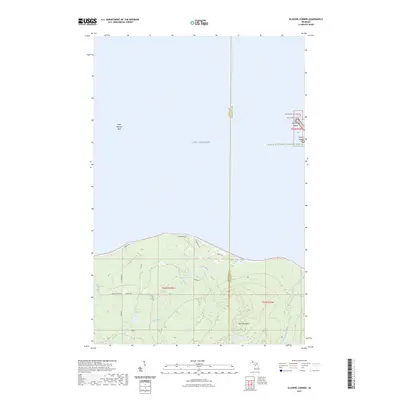
2023 Map of Glovers Corner
USGS Topo · Published 2023About this map
The remote shoreline of Lake Superior meets the densely forested interior of the Upper Peninsula at the boundary of Baraga and Marquette Counties. This coastal environment is defined by its significant conservation areas, notably the Huron Islands Wilderness and the Huron National Wildlife Refuge, which encompass the small archipelago offshore. These islands, including Lighthouse Island, have long served as critical navigational markers for maritime traffic. On the mainland, the landscape rises toward Bald Mountain, with the Huron River and Little Huron River draining through the wooded terrain toward the lake. A limited network of rural routes such as Lower Skanee Rd and Huron Rd provides access to the shoreline, while the dangerous Point Abbaye Reef extends into the open water, illustrating the navigational hazards that necessitated the region's historic lighthouse.
Find a feature on this map
20 named features on this map. Tap any name to fly to it.
Don’t see what you’re looking for? This feature index may not catch every label — zoom into the map to look around manually.
Map Details
Editions of this 2023 Glovers Corner Map
This is the sole edition of this map. No revisions or reprints were ever made.
Other maps of this area

1954 · Huron Mountain
USGS Topo · 1:62,500

1954 · Skanee
USGS Topo · 1:62,500

1958 · Hancock
USGS Topo · 1:250,000

1958 · Marquette
USGS Topo · 1:250,000

1958 · Iron River
USGS Topo · 1:250,000

1960 · Iron River
USGS Topo · 1:250,000

1960 · Hancock
USGS Topo · 1:250,000

1960 · Marquette
USGS Topo · 1:250,000

1961 · Marquette
USGS Topo · 1:250,000

1961 · Iron River
USGS Topo · 1:250,000