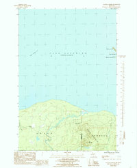
1984 Map of Glovers Corner
USGS Topo · Published 1985About this map
The Huron River and Little Huron River cut through the heavily wooded terrain of the Copper Country State Forest as they flow north toward Lake Superior. This 1984 survey, produced from photography taken in 1981, illustrates the wild interface between the Huron Mountains and the lake's southern shoreline. The landscape is dominated by physical geography, with Bald Mountain rising near the eastern boundary and the treacherous Point Abbaye Reef stretching into the water.
Find a feature on this map
17 named features on this map. Tap any name to fly to it.
Don’t see what you’re looking for? This feature index may not catch every label — zoom into the map to look around manually.
Map Details
Editions of this 1984 Glovers Corner Map
This is the sole edition of this map. No revisions or reprints were ever made.
Other maps of this area

1954 · Huron Mountain
USGS Topo · 1:62,500

1954 · Skanee
USGS Topo · 1:62,500

1958 · Hancock
USGS Topo · 1:250,000

1958 · Marquette
USGS Topo · 1:250,000

1958 · Iron River
USGS Topo · 1:250,000

1960 · Iron River
USGS Topo · 1:250,000

1960 · Hancock
USGS Topo · 1:250,000

1960 · Marquette
USGS Topo · 1:250,000

1961 · Marquette
USGS Topo · 1:250,000

1961 · Iron River
USGS Topo · 1:250,000