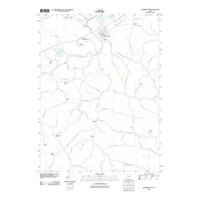
2010 Map of Gnadenhutten
USGS Topo · Published 2010About this map
The Tuscarawas River flows across this landscape, shaping the valley where the historic settlement of Gnadenhutten and the smaller community of Lock Seventeen are situated. The town's layout is clearly defined, featuring the Gnadenhutten Post Office and the Gnadenhutten Cemetery. This region of Tuscarawas County is characterized by a dense network of country roads and family-named landmarks that offer significant value for genealogical research. Numerous burial grounds are scattered throughout the hills and hollows, including the Frys Valley Cemetery, Kennedy Cemetery, and Hartwood Cemetery. To the south, the terrain becomes more dissected around Murphy Hollow and the waters of Phillips Fork, while local recreation is represented by Camp Zimmerman and Lake Greenbriar. The map provides a detailed view of rural life in the early 21st century, from the farms at Fillmans Farms Field to the small crossroads of Gilmore and Hartwood.
Find a feature on this map
79 named features on this map. Tap any name to fly to it.
Don’t see what you’re looking for? This feature index may not catch every label — zoom into the map to look around manually.
Map Details
Editions of this 2010 Gnadenhutten Map
This is the sole edition of this map. No revisions or reprints were ever made.
Other maps of this area

1909 · Antrim
USGS Topo · 1:48,000

1909 · Uhrichsville
USGS Topo · 1:62,500

1909 · Cambridge
USGS Topo · 1:62,500

1911 · Antrim
USGS Topo · 1:62,500

1911 · Uhrichsville
USGS Topo · 1:62,500

1911 · Newcomerstown
USGS Topo · 1:62,500

1912 · Cambridge
USGS Topo · 1:62,500

1913 · Newcomerstown
USGS Topo · 1:62,500

1943 · Newcomerstown
USGS Topo · 1:62,500

1951 · Canton
USGS Topo · 1:250,000