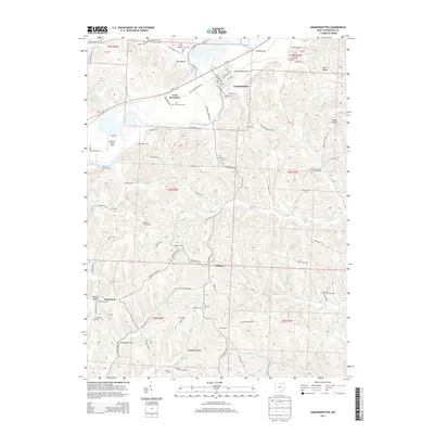
2013 Map of Gnadenhutten
USGS Topo · Published 2013About this map
The Tuscarawas River valley defines this landscape, where the village of Gnadenhutten and the settlement of Lock Seventeen sit along the river's bend. This 2013 survey illustrates the complex topography of the Allegheny Plateau, marked by numerous hollows and valleys like Murphy Hollow, Dutch Valley, and Toad Hollow. The mapping reveals a high density of ancestral burial sites for genealogists, including Schweitzer Cem, Crossroads Cem, and W Union Cem. Transportation corridors are well-established here, with the Gnadenhutten Airport situated near the village and Us-36 cutting through the northern valley. To the south, the terrain becomes more dissected as the road network thins toward Gilmore and Pleasant Valley, where small waterways like Fallen Timber Cr and Phillips Fork drain the high ridges. The map effectively captures the intersection of historical settlement patterns and the physical geography of rural Ohio.
Find a feature on this map
100 named features on this map. Tap any name to fly to it.
Don’t see what you’re looking for? This feature index may not catch every label — zoom into the map to look around manually.
Map Details
Editions of this 2013 Gnadenhutten Map
This is the sole edition of this map. No revisions or reprints were ever made.
Other maps of this area

1909 · Antrim
USGS Topo · 1:48,000

1909 · Uhrichsville
USGS Topo · 1:62,500

1909 · Cambridge
USGS Topo · 1:62,500

1911 · Antrim
USGS Topo · 1:62,500

1911 · Uhrichsville
USGS Topo · 1:62,500

1911 · Newcomerstown
USGS Topo · 1:62,500

1912 · Cambridge
USGS Topo · 1:62,500

1913 · Newcomerstown
USGS Topo · 1:62,500

1943 · Newcomerstown
USGS Topo · 1:62,500

1951 · Canton
USGS Topo · 1:250,000