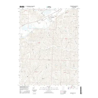
2016 Map of Gnadenhutten
USGS Topo · Published 2016About this map
The Tuscarawas River carves a deep valley through this portion of Tuscarawas County, serving as the primary corridor for both the Ohio Central RR and modern highways. The village of Gnadenhutten sits on the river's eastern bank, surrounded by a landscape of high ridges and named hollows like Toad Hollow and Murphy Hollow. This 2016 survey illustrates the persistent rural character of the region, where numerous small cemeteries such as Frys Valley Cem and West Union Cem are tucked into the upland folds between the river and the settlement of Gilmore. Smaller water bodies like Lake Greenbriar and Lake Page punctuate the higher elevations. The infrastructure of the river valley is further defined by the Gnadenhutten Airport and the historic location of Lock Seventeen, reflecting the area's long-standing role as a transit point through the Appalachian foothills.
Find a feature on this map
126 named features on this map. Tap any name to fly to it.
Don’t see what you’re looking for? This feature index may not catch every label — zoom into the map to look around manually.
Map Details
Editions of this 2016 Gnadenhutten Map
This is the sole edition of this map. No revisions or reprints were ever made.
Other maps of this area

1909 · Antrim
USGS Topo · 1:48,000

1909 · Uhrichsville
USGS Topo · 1:62,500

1909 · Cambridge
USGS Topo · 1:62,500

1911 · Antrim
USGS Topo · 1:62,500

1911 · Uhrichsville
USGS Topo · 1:62,500

1911 · Newcomerstown
USGS Topo · 1:62,500

1912 · Cambridge
USGS Topo · 1:62,500

1913 · Newcomerstown
USGS Topo · 1:62,500

1943 · Newcomerstown
USGS Topo · 1:62,500

1951 · Canton
USGS Topo · 1:250,000