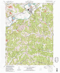
1994 Map of Gnadenhutten
USGS Topo · Published 1998About this map
Gnadenhutten serves as the focal point of this Tuscarawas County landscape, centered on the bend of the Tuscarawas River. The map documents a town deeply connected to its heritage, anchored by the Gnadenhutten Historical Park and the adjacent Gnadenhutten Historical Park Cem. Industrial and infrastructure elements like the Conrail line, several Sand and Gravel Pits, and an Industrial Waste Treatment Plant illustrate the late-20th-century economic landscape of the valley.
Find a feature on this map
57 named features on this map. Tap any name to fly to it.
Don’t see what you’re looking for? This feature index may not catch every label — zoom into the map to look around manually.
Map Details
Editions of this 1994 Gnadenhutten Map
This is the sole edition of this map. No revisions or reprints were ever made.
Other maps of this area

1909 · Antrim
USGS Topo · 1:48,000

1909 · Uhrichsville
USGS Topo · 1:62,500

1909 · Cambridge
USGS Topo · 1:62,500

1911 · Antrim
USGS Topo · 1:62,500

1911 · Uhrichsville
USGS Topo · 1:62,500

1911 · Newcomerstown
USGS Topo · 1:62,500

1912 · Cambridge
USGS Topo · 1:62,500

1913 · Newcomerstown
USGS Topo · 1:62,500

1943 · Newcomerstown
USGS Topo · 1:62,500

1951 · Canton
USGS Topo · 1:250,000