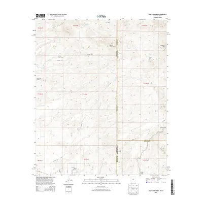
2013 Map of Goat Camp Spring
USGS Topo · Published 2013About this map
Goat Camp Spring lies at the heart of this high-desert landscape, marking a vital water source along the border between Arizona and New Mexico. The terrain is defined by its deep drainage networks, including Sand Wash, Sanders Wash, and Harris Wash, which cut through the high country surrounding Vanderbilt Peak. Human presence is sparse, oriented toward ranching and local transit, with landmarks like Stevens Ranch and the small settlement at Hunter Flat providing points of orientation in a region of vast canyons.
Find a feature on this map
41 named features on this map. Tap any name to fly to it.
Don’t see what you’re looking for? This feature index may not catch every label — zoom into the map to look around manually.
Map Details
Editions of this 2013 Goat Camp Spring Map
This is the sole edition of this map. No revisions or reprints were ever made.
Other maps of this area

1954 · Silver City
USGS Topo · 1:250,000

1958 · Silver City
USGS Topo · 1:250,000

1959 · Steeple Rock
USGS Topo · 1:62,500

1959 · Canador Peak
USGS Topo · 1:62,500

1959 · York Valley
USGS Topo · 1:62,500

1960 · Duncan
USGS Topo · 1:62,500

1962 · Silver City
USGS Topo · 1:250,000
1986 · Sheldon
USGS Topo · 1:24,000
1986 · Duncan
USGS Topo · 1:24,000
1986 · Tillie Hall Peak
USGS Topo · 1:24,000