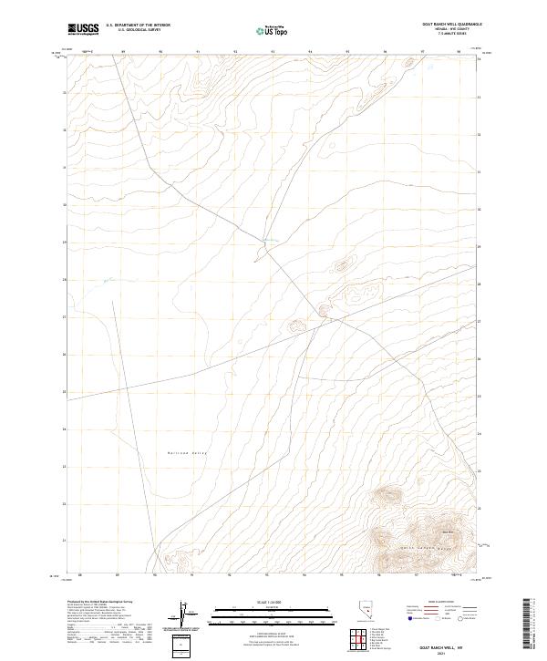
2021 Map of Goat Ranch Well
USGS Topo · Published 2021About this map
Railroad Valley dominates the expansive desert floor of this Nye County landscape, where the flat basin meets the rising elevations of the Quinn Canyon Range to the southeast. The map reveals the essential role of water in this arid environment, marking vital points like Buttes Spring and Hot Cr that have historically sustained life and livestock in the Great Basin. While the topography is largely defined by broad alluvial sweeps, the southern reaches show more complex terrain near Red Hill, a prominent landmark overlooking the valley floor. Researchers and land historians can trace the rectangular grid of the Public Land Survey System, including t4n r53e and surrounding townships, which organizes this part of the Nevada desert into manageable sections for grazing and resource management.
Find a feature on this map
9 named features on this map. Tap any name to fly to it.
Don’t see what you’re looking for? This feature index may not catch every label — zoom into the map to look around manually.
Map Details
Editions of this 2021 Goat Ranch Well Map
This is the sole edition of this map. No revisions or reprints were ever made.
Other maps of this area

1956 · Lund
USGS Topo · 1:250,000

1956 · Tonopah
USGS Topo · 1:250,000

1959 · Tonopah
USGS Topo · 1:250,000

1960 · Lund
USGS Topo · 1:250,000

1962 · Tonopah
USGS Topo · 1:250,000

1967 · Lunar Crater
USGS Topo · 1:62,500
1967 · Chuck Wagon Flat
USGS Topo · 1:24,000
1968 · Reveille
USGS Topo · 1:62,500

1968 · The Wall
USGS Topo · 1:62,500
1968 · The Wall SE
USGS Topo · 1:24,000