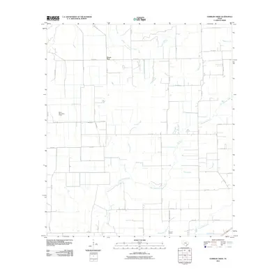
2010 Map of Gobbler Creek
USGS Topo · Published 2010About this map
Round Mott stands as the primary settlement in this agricultural landscape of Wharton County, situated at a junction of rural routes. The terrain is defined by a dense network of seasonal drainages and permanent waterways, including the braided paths of West Mustang Creek, Middle Mustang Creek, and East Mustang Creek. The flat coastal prairie topography is further marked by the Chaco Slough, which meanders through the eastern portion of the quadrangle. Local aviation is represented by the Norris Raun Ranch Airport in the western reaches, while the Procopius Cemetery provides a specific point of interest for those researching family history in the area. A complex grid of county roads, such as Co RD 382 and Co RD 354, connects the dispersed farmsteads and ranches, reflecting the region's enduring reliance on land management and ranching at the start of the 21st century.
Find a feature on this map
36 named features on this map. Tap any name to fly to it.
Don’t see what you’re looking for? This feature index may not catch every label — zoom into the map to look around manually.
Map Details
Editions of this 2010 Gobbler Creek Map
This is the sole edition of this map. No revisions or reprints were ever made.
Other maps of this area

1953 · Seguin
USGS Topo · 1:250,000

1958 · Seguin
USGS Topo · 1:250,000

1960 · New Taiton
USGS Topo · 1:24,000

1963 · Ganado
USGS Topo · 1:24,000

1965 · El Campo
USGS Topo · 1:24,000

1965 · Ganado NE
USGS Topo · 1:24,000

1965 · Sheridan SE
USGS Topo · 1:24,000

1965 · Gobbler Creek
USGS Topo · 1:24,000
1965 · El Campo SE
USGS Topo · 1:24,000
1965 · Hahn
USGS Topo · 1:24,000