
1965 Map of Ganado NE
USGS Topo · Published 1967About this map
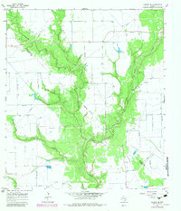
The low-lying coastal plains of the Texas Gulf Coast define this mid-1960s landscape, where the meandering course of Sandy Creek dominates the terrain as it flows southward. The drainage network is particularly complex here, featuring the winding Goldenrod Creek and the curiously named Lost River, which thread through dense vegetation corridors. An Indefinite Boundary snakes through the central portion of the map, marking the divide between Wharton and Jackson Counties.
Find a feature on this map
14 named features on this map. Tap any name to fly to it.
Don’t see what you’re looking for? This feature index may not catch every label — zoom into the map to look around manually.
Map Details
Editions of this 1965 Ganado NE Map
2 editions found
Other maps of this area

1953 · Seguin
USGS Topo · 1:250,000

1958 · Seguin
USGS Topo · 1:250,000

1963 · Ganado
USGS Topo · 1:24,000

1963 · Mount Olive
USGS Topo · 1:24,000

1964 · Cordele
USGS Topo · 1:24,000

1964 · Speaks
USGS Topo · 1:24,000

1965 · Sheridan SE
USGS Topo · 1:24,000

1965 · Gobbler Creek
USGS Topo · 1:24,000
1965 · Hahn
USGS Topo · 1:24,000
1965 · Louise
USGS Topo · 1:24,000