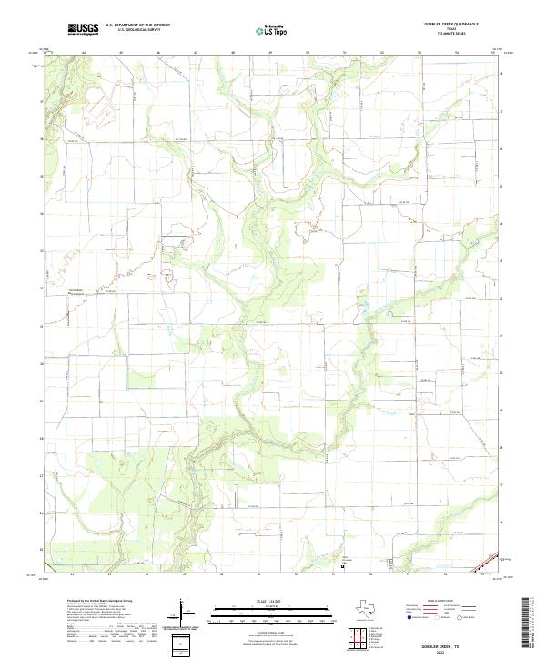
2022 Map of Gobbler Creek
USGS Topo · Published 2022About this map
W Mustang Cr and its various tributaries, including Middle Mustang Cr and E Mustang Cr, define the drainage patterns of this Wharton County landscape. The area is characterized by a dense grid of rural roads and large agricultural tracts typical of the Texas coastal plains. In the southern portion of the quadrangle, Saint Procopius Cem serves as a significant local landmark for genealogical researchers, while the Norris Raun Ranch Airport provides a distinct navigational point in the west. The presence of Chaco Slough and named branches like Mott Br and Coon Br indicates a low-lying, water-rich environment where natural drainage channels weave between cultivated fields and farmsteads. This network of small waterways and county roads reveals a persistent rural settlement pattern that has remained centered on ranching and agriculture into the 21st century.
Find a feature on this map
43 named features on this map. Tap any name to fly to it.
Don’t see what you’re looking for? This feature index may not catch every label — zoom into the map to look around manually.
Map Details
Editions of this 2022 Gobbler Creek Map
This is the sole edition of this map. No revisions or reprints were ever made.
Other maps of this area

1953 · Seguin
USGS Topo · 1:250,000

1958 · Seguin
USGS Topo · 1:250,000

1960 · New Taiton
USGS Topo · 1:24,000

1963 · Ganado
USGS Topo · 1:24,000

1965 · El Campo
USGS Topo · 1:24,000

1965 · Ganado NE
USGS Topo · 1:24,000

1965 · Sheridan SE
USGS Topo · 1:24,000

1965 · Gobbler Creek
USGS Topo · 1:24,000
1965 · El Campo SE
USGS Topo · 1:24,000
1965 · Hahn
USGS Topo · 1:24,000