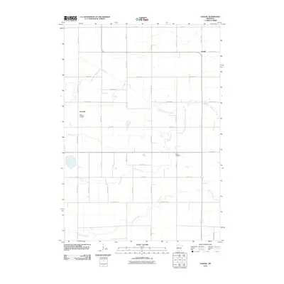
2010 Map of Godahl
USGS Topo · Published 2010About this map
Godahl and the surrounding Watonwan County countryside appear here as a landscape defined by a rigid grid of township roads and the winding paths of several waterways. The settlement of Sveadahl is a focal point for genealogical interest, anchored by two distinct burial grounds: the West Sveadahl Cemetery and the East Sveadahl Cemetery. This area of southern Minnesota is shaped by the drainage patterns of the North Fork Watonwan River and the Watonwan River, which cut across the geometric precision of the local road network. The southern portion of the quadrangle is further detailed by the course of Butterfield Creek. The map provides a precise view of rural infrastructure, tracing the paths of numerous routes such as County Hwy-1 and County Hwy-116, which connect the scattered farmsteads and small communities during the early 21st century.
Find a feature on this map
34 named features on this map. Tap any name to fly to it.
Don’t see what you’re looking for? This feature index may not catch every label — zoom into the map to look around manually.
Map Details
Editions of this 2010 Godahl Map
This is the sole edition of this map. No revisions or reprints were ever made.
Other maps of this area

1953 · New Ulm
USGS Topo · 1:250,000

1954 · Fairmont
USGS Topo · 1:250,000

1957 · New Ulm
USGS Topo · 1:250,000

1958 · New Ulm
USGS Topo · 1:250,000

1958 · Fairmont
USGS Topo · 1:250,000

1967 · New Ulm
USGS Topo · 1:250,000

1967 · Lake Hanska West
USGS Topo · 1:24,000

1967 · Godahl
USGS Topo · 1:24,000

1967 · Darfur
USGS Topo · 1:24,000
1967 · Lake Hanska East
USGS Topo · 1:24,000