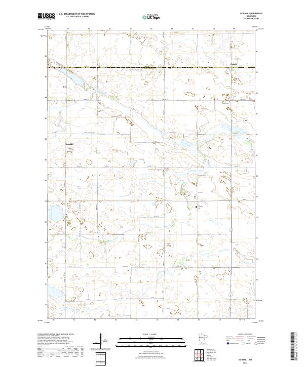
2022 Map of Godahl
USGS Topo · Published 2022About this map
Godahl sits at the junction of Brown Co and Watonwan Co, anchoring a landscape of agricultural tradition in Southern Minnesota. The area is defined by the winding paths of the N Fork Watonwan River and the main branch of the Watonwan River, which converge amidst a grid of rural township roads and county highways. To the west, the community of Sveadahl preserves its local history through the West Sveadahl Cem and East Sveadahl Cem, marking the enduring presence of early settler families. In the southern portion of the quadrangle, Butterfield Cr cuts through the terrain near the border of t106n r32w. This 2022 survey illustrates the modern layout of sections and farmsteads that have shaped this prairie region for generations.
Find a feature on this map
49 named features on this map. Tap any name to fly to it.
Don’t see what you’re looking for? This feature index may not catch every label — zoom into the map to look around manually.
Map Details
Editions of this 2022 Godahl Map
This is the sole edition of this map. No revisions or reprints were ever made.
Other maps of this area

1953 · New Ulm
USGS Topo · 1:250,000

1954 · Fairmont
USGS Topo · 1:250,000

1957 · New Ulm
USGS Topo · 1:250,000

1958 · New Ulm
USGS Topo · 1:250,000

1958 · Fairmont
USGS Topo · 1:250,000

1967 · New Ulm
USGS Topo · 1:250,000

1967 · Lake Hanska West
USGS Topo · 1:24,000

1967 · Godahl
USGS Topo · 1:24,000

1967 · Darfur
USGS Topo · 1:24,000
1967 · Lake Hanska East
USGS Topo · 1:24,000