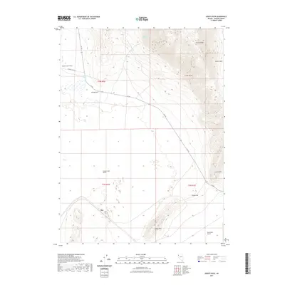
2021 Map of Godeys Rock
USGS Topo · Published 2021About this map
The Smoke Creek Desert and Black Rock Desert meet in this high-desert corridor of Washoe County, where the stark transition from alkali flats to the Granite Range is clearly defined. The landscape is marked by essential water sources like Deep Hole Spring and Gerlach Spring, which have long served travelers moving through this arid terrain. A solitary point labeled Phil sits near the base of the mountains, suggesting a localized landmark or specific property within the vast basin.
Find a feature on this map
20 named features on this map. Tap any name to fly to it.
Don’t see what you’re looking for? This feature index may not catch every label — zoom into the map to look around manually.
Map Details
Editions of this 2021 Godeys Rock Map
This is the sole edition of this map. No revisions or reprints were ever made.
Other maps of this area

1886 · Granite Range
USGS Topo · 1:250,000

1894 · Granite Range
USGS Topo · 1:250,000

1955 · Lovelock
USGS Topo · 1:250,000

1959 · Lovelock
USGS Topo · 1:250,000

1964 · Gerlach
USGS Topo · 1:62,500
1980 · The Banjo
USGS Topo · 1:24,000

1980 · Wall Spring
USGS Topo · 1:24,000

1980 · Smith Canyon
USGS Topo · 1:24,000
1980 · Hualapai Flat South
USGS Topo · 1:24,000
1981 · Squaw Valley
USGS Topo · 1:24,000