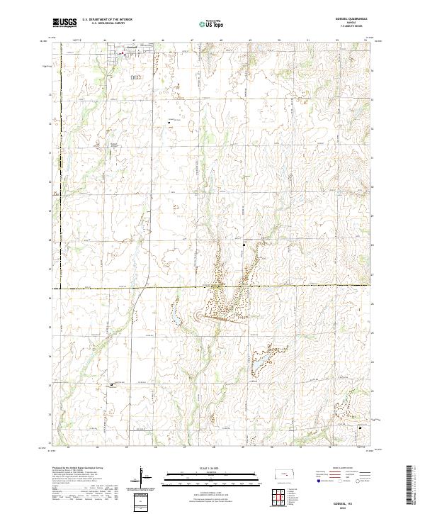
2022 Map of Goessel
USGS Topo · Published 2022About this map
The community of Goessel serves as the focal point for this section of the Kansas prairie, situated at the intersection of Marion, McPherson, and Harvey counties. This 2022 survey documents a landscape defined by organized agricultural plots and the drainage patterns of several creeks, including Middle Emma Creek and E Emma Creek. The map provides a high level of detail for local genealogy, showing several scattered rural burying grounds like Groenfeld Cemetery and Schoenthal Cemetery, which reflect the early Mennonite and German-heritage settlement of the region. Transportation is anchored by a grid of rural routes such as N Kansas Rd and Centennial Dr, while the Hiebert Airfield illustrates the continued use of private landing strips across the plains. These features together show a resilient rural economy where small-town life and family-named landmarks persist into the modern era.
Find a feature on this map
26 named features on this map. Tap any name to fly to it.
Don’t see what you’re looking for? This feature index may not catch every label — zoom into the map to look around manually.
Map Details
Editions of this 2022 Goessel Map
This is the sole edition of this map. No revisions or reprints were ever made.
Other maps of this area

1889 · Newton
USGS Topo · 1:125,000

1894 · Newton
USGS Topo · 1:125,000

1955 · Hutchinson
USGS Topo · 1:250,000

1957 · Newton
USGS Topo · 1:24,000

1957 · Peabody NW
USGS Topo · 1:24,000

1957 · Elbing
USGS Topo · 1:24,000

1959 · Hutchinson
USGS Topo · 1:250,000
1959 · Zimmerdale
USGS Topo · 1:24,000

1965 · Goessel
USGS Topo · 1:24,000
1965 · Hesston
USGS Topo · 1:24,000